
Savage Gulf State Park
Savage Gulf State Park, located in Grundy and Sequatchie counties, features one of Tennessee’s most scenic wilderness areas, including the nearly 19,000-acre Savage Gulf State Natural Area. The park offers approximately 60 miles of hiking to remarkable vistas, waterfalls, and historical locations such as the Stagecoach Road. The Great Stone Door is an impressive cliff line overlooking the Savage Gulf. It gets its name from a crack in the cliff that runs from the top to the bottom, resembling a door left slightly ajar. This is one of the many ways to access the gulf below. Many of the trails are perfect for wildflower hunts as the hiker traverses the different environs of the top of the plateau and the deep gulfs.
The park includes land formerly managed as part of South Cumberland State Park. The Tennessee General Assembly provided $30,380,000 for future improvements, including a visitors center, RV campground, and infrastructure to support these new facilities. For now, current access points into the park remain as is.
Savage Gulf has nine backcountry campgrounds (Hobbs, Dinky Line, Savage Falls, Stagecoach Road, Collin West, Savage Station, Alum Gap, Sawmill, and Stone Door) that can be reserved online.
The park has four trailhead parking lots. The Savage Gulf North parking area offers restroom facilities, a ranger station, a picnic area, and a picnic pavilion. The bluffs at Stone Door offer visitors the opportunity to 'rock climb and rappel' with seven designated routes

Trailheads

Savage Gulf West / Greeter Falls
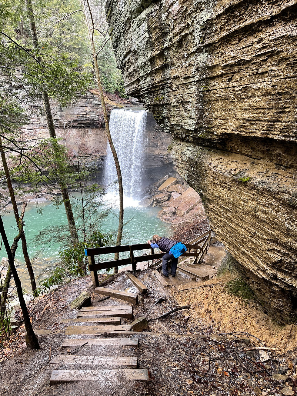
Greeter Falls Day Loop is a moderate to strenuous 1.4 mile trail that offers three waterfalls, swimming, magnificent rock formations, and a rock scramble along a high narrow ledge under the bluff.
Blue Hole Trail descends about 150 feet to Firescald Creek and the Blue Hole. It’s easy for most of the way, with some steeply rocky going at the end.
Horsepound Falls is a difficult 2 mile out-and-back viewing Suter Falls, rock shelters, and high bluffs with a 2 mile continuation to Horsepound Falls, a unique waterfall formation with overlooks and lush wildflowers in the spring.


Savage Gulf South / Collins Gulf
Suter Falls Trail is a difficult 2 mile out-and-back viewing Suter Falls, rock shelters, and high bluffs. If you wish to continue on, 2 miles past Suter Falls you'll come to Horsepound Falls, a unique waterfall formation with overlooks and lush wildflowers in the spring.
Activities
Meet the Rangers
Proudly supported by our community partners

Silver Partner

Bronze Partner