top of page

Pack Hollow (formerly Lost Cove East) Trailhead

Pack Hollow (formerly Lost Cove East)

Hikes

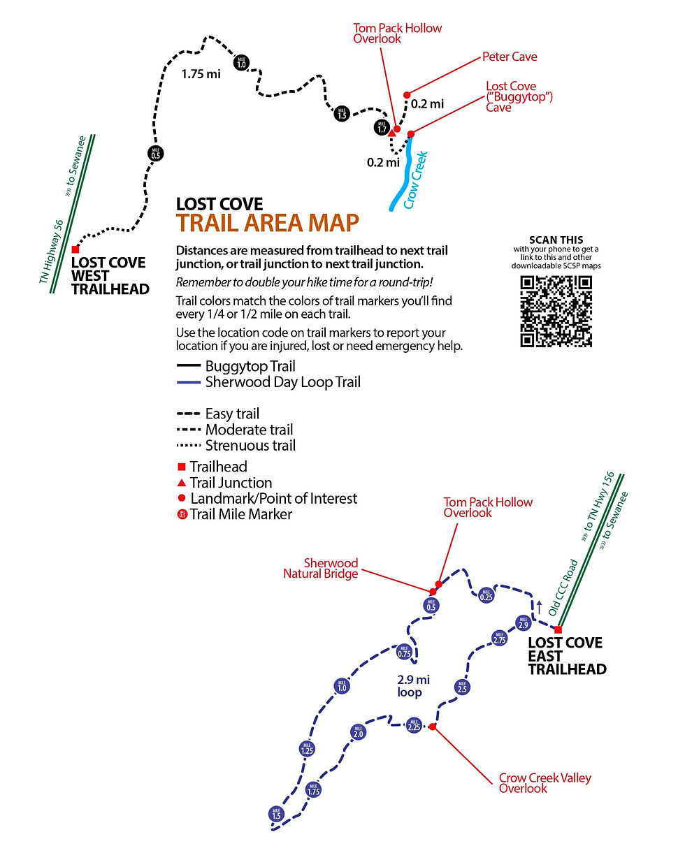
Sherwood Day Loop

Day Hikes

An easy and rewarding 2.4 mile loop trail that includes a visit to the Sherwood Natural Bridge, unique rock formations, and several outstanding overlooks, where you can see nearly 17 miles into Franklin County.

Day Hikes

Sherwood Day Loop

Easy

An easy and rewarding 2.4 mile loop trail that includes a visit to the Sherwood Natural Bridge, unique rock formations, and several outstanding overlooks, where you can see nearly 17 miles into Franklin County.

Make a one-time or recurring donation to empower a group working to save great spaces in the South Cumberland and help protect and maintain these magnificent parks.

Become a member to support the work of Friends of the Parks, receive the monthly Trail Tracker newsletter and members-only events.

There are literally hundreds of ways you can get involved with the Friends of the Parks and provide critical support to our state park rangers, managers, and staff

Important Info

Day Hikes

Be prepared for your hike! Know when the sun will set, and make sure you bring along these essentials...

Overlooks

Many overlooks do not have protective barriers. Keep a close eye on children and be careful!

Pack Hollow (formerly Lost Cove East)

Maps & Trail Guides

Lost Cove SimpleMap
Lost Cove SimpleMap
Lost Cove Topographic Map
Lost Cove East - Sherwood Trail Guide

Visit our Nearby Business Members

Shenanigans
Shenanigans
More to do in Sewanee

Getting There

Take Jumpoff Road (TN Hwy 156) south from Sewanee about 8.5 miles and look for Old CCC Road, a dirt road (one-half mile on your right past Lake Road, which is better-marked with a brown park post, white letters). Follow Old CCC Road about 2 miles, through the park gate, out to its end; the trailhead parking lot is on your right.

bottom of page